AI & ML Models
0.0 (0 reviews) • 0 downloads
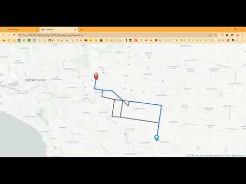
Traffic Flow Map With TKInter in Python Projects
र 1000
Traffic Flow Map With TKInter in Python Projects
Technical Details
Domain : Python
Database : Sqlite
Tools : Anaconda
Run Tools: VS Code
Database : Sqlite
Tools : Anaconda
Run Tools: VS Code
Secure Payment
Instant Download
GST Invoice
24/7 Support
About This Product
Traffic Flow Map With TKInter in Python Projects
Abstract
Efficient traffic management is essential to reduce congestion, save time, and improve road safety in urban areas. This project focuses on Traffic Flow Mapping using TKInter in Python, which visualizes real-time traffic conditions on a city map and provides analytical insights. The system collects traffic data such as vehicle counts, speed, and congestion levels from sensors, GPS devices, or public datasets. Python’s TKInter library is used to build a graphical user interface (GUI) for interactive visualization of traffic flow on city maps. Additional libraries like Pandas, NumPy, and Matplotlib are used for data preprocessing, analysis, and plotting. The project aims to help city planners, traffic authorities, and commuters monitor traffic patterns, plan optimal routes, and make data-driven decisions to improve urban mobility.
Existing System
Current traffic monitoring systems largely rely on GPS-based navigation apps or manual monitoring through CCTV cameras and traffic reports. These systems provide static or delayed information about traffic congestion and often lack interactive visualizations for analysis. Many traditional platforms focus on text-based or tabular representations of traffic data, which are less intuitive and difficult to interpret for route planning. Existing solutions also fail to integrate real-time traffic updates with a user-friendly interface, limiting their usability for daily commuters or city traffic management authorities.
Proposed System
The proposed system introduces a Python-based GUI traffic flow mapping system using TKInter. Real-time or historical traffic data is collected, cleaned, and processed using Pandas and NumPy. The processed data is then visualized on a city map using TKInter widgets and Matplotlib plots, displaying traffic density, vehicle flow, and congestion hotspots. The interface allows users to interactively view different regions, select time intervals, and monitor traffic trends. The system can also highlight optimal routes based on current traffic conditions. By integrating GUI-based visualization with real-time traffic data analysis, the system provides an accessible and intuitive tool for commuters and traffic authorities, enabling efficient traffic monitoring, informed decision-making, and better urban mobility management.
Abstract
Efficient traffic management is essential to reduce congestion, save time, and improve road safety in urban areas. This project focuses on Traffic Flow Mapping using TKInter in Python, which visualizes real-time traffic conditions on a city map and provides analytical insights. The system collects traffic data such as vehicle counts, speed, and congestion levels from sensors, GPS devices, or public datasets. Python’s TKInter library is used to build a graphical user interface (GUI) for interactive visualization of traffic flow on city maps. Additional libraries like Pandas, NumPy, and Matplotlib are used for data preprocessing, analysis, and plotting. The project aims to help city planners, traffic authorities, and commuters monitor traffic patterns, plan optimal routes, and make data-driven decisions to improve urban mobility.
Existing System
Current traffic monitoring systems largely rely on GPS-based navigation apps or manual monitoring through CCTV cameras and traffic reports. These systems provide static or delayed information about traffic congestion and often lack interactive visualizations for analysis. Many traditional platforms focus on text-based or tabular representations of traffic data, which are less intuitive and difficult to interpret for route planning. Existing solutions also fail to integrate real-time traffic updates with a user-friendly interface, limiting their usability for daily commuters or city traffic management authorities.
Proposed System
The proposed system introduces a Python-based GUI traffic flow mapping system using TKInter. Real-time or historical traffic data is collected, cleaned, and processed using Pandas and NumPy. The processed data is then visualized on a city map using TKInter widgets and Matplotlib plots, displaying traffic density, vehicle flow, and congestion hotspots. The interface allows users to interactively view different regions, select time intervals, and monitor traffic trends. The system can also highlight optimal routes based on current traffic conditions. By integrating GUI-based visualization with real-time traffic data analysis, the system provides an accessible and intuitive tool for commuters and traffic authorities, enabling efficient traffic monitoring, informed decision-making, and better urban mobility management.
Customer Reviews (0)
No reviews yet. Be the first!
Related Products
⭐ Featured
AI & ML Models
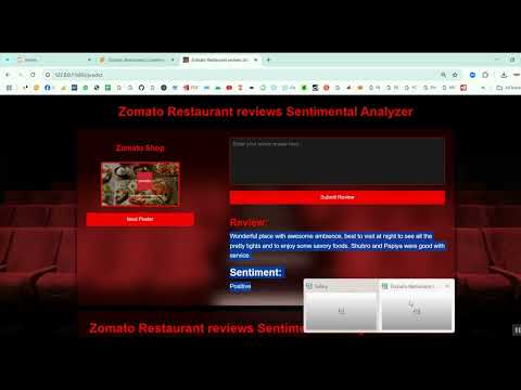
Zomato Restaurant Reviews Sentimental Analyzer in Python Projects
Zomato Restaurant Reviews Sentimental Analyzer in Python Projects
र 1000
⭐ Featured
⭐ Featured
AI & ML Models
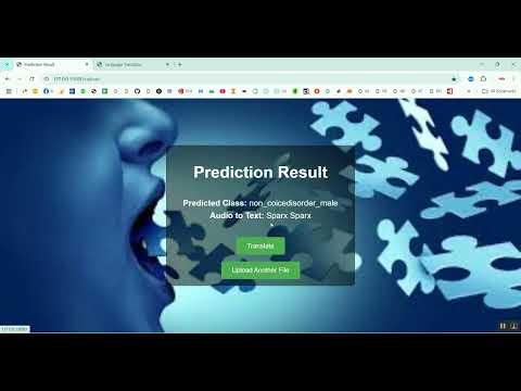
Voice Disorder Prediction using Audio Dataset in Python Projects
Voice Disorder Prediction using Audio Dataset in Python Projects
र 1000
AI & ML Models
Vitamin Deficiency Detection Using Image Processing in Python Projects
Vitamin Deficiency Detection Using Image Processing in Python Projects
र 1000