AI & ML Models
0.0 (0 reviews) • 0 downloads
Traffic Flow Forecasting Route Navigator in Python Projects
र 1000
Traffic Flow Forecasting Route Navigator in Python Projects
Technical Details
Domain : Python
Database : Sqlite
Tools : Anaconda
Run Tools: VS Code
Database : Sqlite
Tools : Anaconda
Run Tools: VS Code
Secure Payment
Instant Download
GST Invoice
24/7 Support
About This Product
Traffic Flow Forecasting Route Navigator in Python Projects
Abstract
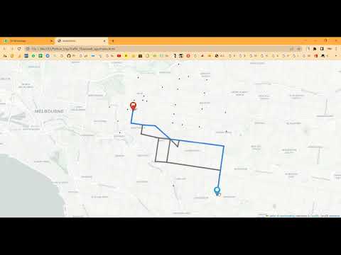
Traffic congestion is a major issue in urban areas, causing delays, increased fuel consumption, and environmental pollution. This project focuses on Traffic Flow Forecasting and Route Navigation using Python, which predicts traffic conditions on roads and recommends optimal routes in real-time. The system collects traffic data such as vehicle count, speed, and road conditions from sensors, GPS devices, and public datasets. Machine learning models, including LSTM networks and regression techniques, are employed to forecast traffic flow and congestion patterns. Python libraries such as Pandas, NumPy, Matplotlib, Scikit-learn, and TensorFlow/Keras are used for data preprocessing, visualization, and predictive modeling. The project aims to provide intelligent navigation, reduce travel time, and improve urban mobility planning.
Existing System
Existing traffic navigation systems, such as basic GPS-based apps, primarily rely on current traffic conditions and shortest-path algorithms to suggest routes. These systems often fail to account for predicted congestion, dynamic events, or long-term traffic patterns. Traditional traffic forecasting methods use statistical models like ARIMA or moving averages, which struggle to capture complex, non-linear, and time-dependent traffic flows. Moreover, these methods cannot provide proactive guidance for route optimization in real-time. Consequently, drivers may experience delays due to unforeseen traffic jams, accidents, or peak-hour congestion, highlighting the need for predictive and intelligent traffic navigation solutions.
Proposed System
The proposed system integrates traffic flow forecasting with route navigation using machine learning and Python-based analytics. Historical and real-time traffic data are preprocessed, normalized, and used to train predictive models such as LSTM networks, CNN-LSTM hybrids, or regression-based time series models. The system predicts traffic congestion for different road segments and dynamically calculates the optimal route considering travel time, distance, and predicted congestion levels. Visualization dashboards using Matplotlib, Plotly, or Folium display traffic patterns, recommended routes, and congestion forecasts in real-time. By combining prediction and navigation, the system not only guides drivers efficiently but also supports city planners in traffic management. This intelligent system reduces travel time, fuel consumption, and traffic congestion, enhancing urban mobility and commuter experience.
Abstract
Traffic congestion is a major issue in urban areas, causing delays, increased fuel consumption, and environmental pollution. This project focuses on Traffic Flow Forecasting and Route Navigation using Python, which predicts traffic conditions on roads and recommends optimal routes in real-time. The system collects traffic data such as vehicle count, speed, and road conditions from sensors, GPS devices, and public datasets. Machine learning models, including LSTM networks and regression techniques, are employed to forecast traffic flow and congestion patterns. Python libraries such as Pandas, NumPy, Matplotlib, Scikit-learn, and TensorFlow/Keras are used for data preprocessing, visualization, and predictive modeling. The project aims to provide intelligent navigation, reduce travel time, and improve urban mobility planning.
Existing System
Existing traffic navigation systems, such as basic GPS-based apps, primarily rely on current traffic conditions and shortest-path algorithms to suggest routes. These systems often fail to account for predicted congestion, dynamic events, or long-term traffic patterns. Traditional traffic forecasting methods use statistical models like ARIMA or moving averages, which struggle to capture complex, non-linear, and time-dependent traffic flows. Moreover, these methods cannot provide proactive guidance for route optimization in real-time. Consequently, drivers may experience delays due to unforeseen traffic jams, accidents, or peak-hour congestion, highlighting the need for predictive and intelligent traffic navigation solutions.
Proposed System
The proposed system integrates traffic flow forecasting with route navigation using machine learning and Python-based analytics. Historical and real-time traffic data are preprocessed, normalized, and used to train predictive models such as LSTM networks, CNN-LSTM hybrids, or regression-based time series models. The system predicts traffic congestion for different road segments and dynamically calculates the optimal route considering travel time, distance, and predicted congestion levels. Visualization dashboards using Matplotlib, Plotly, or Folium display traffic patterns, recommended routes, and congestion forecasts in real-time. By combining prediction and navigation, the system not only guides drivers efficiently but also supports city planners in traffic management. This intelligent system reduces travel time, fuel consumption, and traffic congestion, enhancing urban mobility and commuter experience.
Customer Reviews (0)
No reviews yet. Be the first!
Related Products
⭐ Featured
AI & ML Models
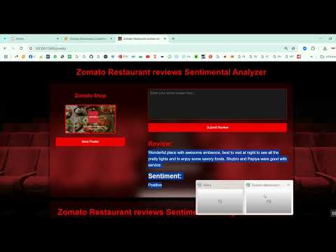
Zomato Restaurant Reviews Sentimental Analyzer in Python Projects
Zomato Restaurant Reviews Sentimental Analyzer in Python Projects
र 1000
⭐ Featured
⭐ Featured
AI & ML Models
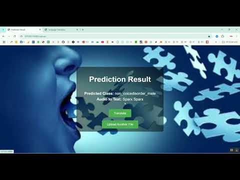
Voice Disorder Prediction using Audio Dataset in Python Projects
Voice Disorder Prediction using Audio Dataset in Python Projects
र 1000
AI & ML Models
Vitamin Deficiency Detection Using Image Processing in Python Projects
Vitamin Deficiency Detection Using Image Processing in Python Projects
र 1000