AI & ML Models
0.0 (0 reviews) • 0 downloads
Agriculture Land Boundaries Segment in Python Projects
र 1000
Agriculture Land Boundaries Segment in Python Projects
Technical Details
Domain : Python
Database : Sqlite
Tools : Anaconda
Run Tools: VS Code
Database : Sqlite
Tools : Anaconda
Run Tools: VS Code
Secure Payment
Instant Download
GST Invoice
24/7 Support
About This Product
Agriculture Land Boundaries Segment in Python Projects
Abstract
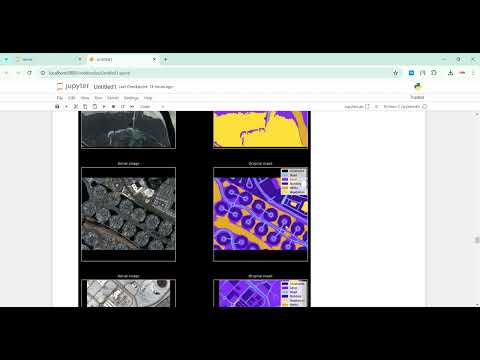
Agricultural land boundary segmentation is an essential task in precision farming, land management, and government land monitoring. Accurate identification of farm boundaries helps in crop planning, irrigation management, yield prediction, and resolving land disputes. Traditional methods rely on manual land surveys and paper-based land maps, which are time-consuming, error-prone, and expensive. This project uses Python-based image processing and deep learning techniques to automatically segment and extract agricultural land boundaries from satellite images or drone-captured farmland images. Libraries such as OpenCV, NumPy, Rasterio, GDAL, and deep learning frameworks like TensorFlow or PyTorch are employed to detect field boundaries through edge detection, segmentation algorithms, and contour extraction techniques. The system enhances segmentation accuracy using models like U-Net, Mask R-CNN, or Watershed segmentation, making it highly suitable for smart agriculture applications. The output generates clearly marked field boundaries that support land monitoring systems and agricultural decision-making platforms.
Existing System
In the existing system, agricultural land boundaries are usually identified through manual land surveys and traditional GIS-based mapping. Surveyors physically visit the land area, measure plot dimensions using basic tools, and prepare boundary maps using CAD or GIS software. This process is slow, resource-intensive, and vulnerable to measurement errors and human bias. Moreover, most small farmers in rural areas do not have access to advanced GIS tools due to affordability and lack of technical knowledge. Satellite maps provided by online sources like Google Maps or government portals are often low in resolution and do not clearly highlight agricultural plot boundaries. The existing methods lack automation and scalability and are not capable of processing large agricultural regions for monitoring and planning. Additionally, traditional systems cannot dynamically detect changes in agricultural boundaries due to natural events, land encroachment, or expansion of farming areas. Hence, the current system is inefficient and lacks precision and automation.
Proposed System
The proposed system introduces an automated Python-based agricultural land boundary segmentation model that leverages remote sensing and image processing techniques. High-resolution farmland images from satellite data (e.g., Sentinel, Landsat) or drone surveys are used as input. The system preprocesses these images using image enhancement, thresholding, histogram equalization, and noise removal to highlight land features. Advanced segmentation techniques like Canny Edge Detection, Watershed Algorithm, U-Net Deep Learning Model, or Morphological Operations are applied to extract boundary lines accurately. The program then converts extracted contours into georeferenced shapefiles using GIS integration, making the output compatible with agricultural mapping systems. The proposed system enables farmers, researchers, and government agencies to automatically generate precise land boundary maps without manual measurement. It supports decision-making for crop zoning, land ownership verification, and irrigation resource planning. This automated model is accurate, scalable, cost-effective, and suitable for real-world precision agriculture applications.
Abstract
Agricultural land boundary segmentation is an essential task in precision farming, land management, and government land monitoring. Accurate identification of farm boundaries helps in crop planning, irrigation management, yield prediction, and resolving land disputes. Traditional methods rely on manual land surveys and paper-based land maps, which are time-consuming, error-prone, and expensive. This project uses Python-based image processing and deep learning techniques to automatically segment and extract agricultural land boundaries from satellite images or drone-captured farmland images. Libraries such as OpenCV, NumPy, Rasterio, GDAL, and deep learning frameworks like TensorFlow or PyTorch are employed to detect field boundaries through edge detection, segmentation algorithms, and contour extraction techniques. The system enhances segmentation accuracy using models like U-Net, Mask R-CNN, or Watershed segmentation, making it highly suitable for smart agriculture applications. The output generates clearly marked field boundaries that support land monitoring systems and agricultural decision-making platforms.
Existing System
In the existing system, agricultural land boundaries are usually identified through manual land surveys and traditional GIS-based mapping. Surveyors physically visit the land area, measure plot dimensions using basic tools, and prepare boundary maps using CAD or GIS software. This process is slow, resource-intensive, and vulnerable to measurement errors and human bias. Moreover, most small farmers in rural areas do not have access to advanced GIS tools due to affordability and lack of technical knowledge. Satellite maps provided by online sources like Google Maps or government portals are often low in resolution and do not clearly highlight agricultural plot boundaries. The existing methods lack automation and scalability and are not capable of processing large agricultural regions for monitoring and planning. Additionally, traditional systems cannot dynamically detect changes in agricultural boundaries due to natural events, land encroachment, or expansion of farming areas. Hence, the current system is inefficient and lacks precision and automation.
Proposed System
The proposed system introduces an automated Python-based agricultural land boundary segmentation model that leverages remote sensing and image processing techniques. High-resolution farmland images from satellite data (e.g., Sentinel, Landsat) or drone surveys are used as input. The system preprocesses these images using image enhancement, thresholding, histogram equalization, and noise removal to highlight land features. Advanced segmentation techniques like Canny Edge Detection, Watershed Algorithm, U-Net Deep Learning Model, or Morphological Operations are applied to extract boundary lines accurately. The program then converts extracted contours into georeferenced shapefiles using GIS integration, making the output compatible with agricultural mapping systems. The proposed system enables farmers, researchers, and government agencies to automatically generate precise land boundary maps without manual measurement. It supports decision-making for crop zoning, land ownership verification, and irrigation resource planning. This automated model is accurate, scalable, cost-effective, and suitable for real-world precision agriculture applications.
Customer Reviews (0)
No reviews yet. Be the first!
Related Products
⭐ Featured
AI & ML Models
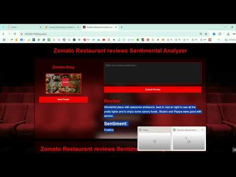
Zomato Restaurant Reviews Sentimental Analyzer in Python Projects
Zomato Restaurant Reviews Sentimental Analyzer in Python Projects
र 1000
⭐ Featured
⭐ Featured
AI & ML Models
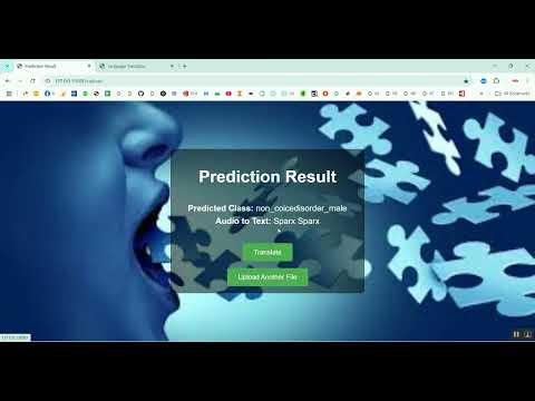
Voice Disorder Prediction using Audio Dataset in Python Projects
Voice Disorder Prediction using Audio Dataset in Python Projects
र 1000
AI & ML Models
Vitamin Deficiency Detection Using Image Processing in Python Projects
Vitamin Deficiency Detection Using Image Processing in Python Projects
र 1000