AI & ML Models
0.0 (0 reviews) • 0 downloads
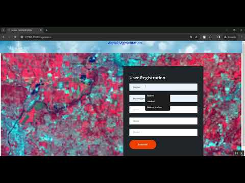
Aerial Segmentation Prediction Flask Application in Python Projects
र 1000
Aerial Segmentation Prediction Flask Application in Python Projects
Technical Details
Domain : Python
Database : Sqlite
Tools : Anaconda
Run Tools: VS Code
Database : Sqlite
Tools : Anaconda
Run Tools: VS Code
Secure Payment
Instant Download
GST Invoice
24/7 Support
About This Product
Aerial Segmentation Prediction Flask Application in Python Projects
Abstract
Aerial image segmentation is an essential task in remote sensing, urban planning, agriculture monitoring, and disaster management. This project focuses on Aerial Segmentation Prediction using Deep Learning integrated with a Flask Web Application in Python. The system takes aerial or satellite images as input and segments them into meaningful regions such as buildings, roads, vegetation, water bodies, and land areas. Convolutional Neural Network (CNN)-based architectures such as U-Net, SegNet, or DeepLab are trained using annotated aerial datasets to perform pixel-level classification. The model output generates segmentation masks that highlight specific terrain or object classes. The Flask framework is used to deploy the trained segmentation model as a user-friendly web application that allows users to upload aerial images and view segmentation results instantly. This project provides an automated and intelligent solution for geospatial analysis and land cover classification.
Existing System
Existing aerial image analysis systems rely heavily on manual interpretation by experts, which is time-consuming, labor-intensive, and prone to human errors. Traditional segmentation techniques use threshold-based or clustering algorithms like K-means or Region Growing, which struggle to handle complex and high-resolution aerial imagery. These methods perform poorly when dealing with variations in terrain, lighting conditions, object shapes, and overlapping regions. Additionally, many legacy systems lack automation and real-time processing capability, making large-scale geospatial analysis slow and inefficient. There is also limited access to lightweight web-based tools that can process aerial segmentation efficiently for practical applications.
Proposed System
The proposed system provides an intelligent and automated Aerial Segmentation Prediction Flask Application using deep learning techniques. A CNN-based model such as U-Net or SegNet is trained on labeled aerial imagery to learn spatial and contextual features for accurate pixel-level segmentation. The uploaded image is preprocessed, resized, and passed through the segmentation model to generate a colored segmentation mask that identifies regions like roads, vegetation, buildings, and water bodies. The Flask-based interface allows users to upload aerial images easily and view segmentation results in real-time. The system delivers fast and accurate land cover analysis, supports geospatial decision-making, and reduces manual workload. It is scalable for applications in smart city planning, agriculture, forestry, mapping, and disaster relief operations.
Customer Reviews (0)
No reviews yet. Be the first!
Related Products
⭐ Featured
AI & ML Models
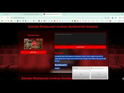
Zomato Restaurant Reviews Sentimental Analyzer in Python Projects
Zomato Restaurant Reviews Sentimental Analyzer in Python Projects
र 1000
⭐ Featured
⭐ Featured
AI & ML Models
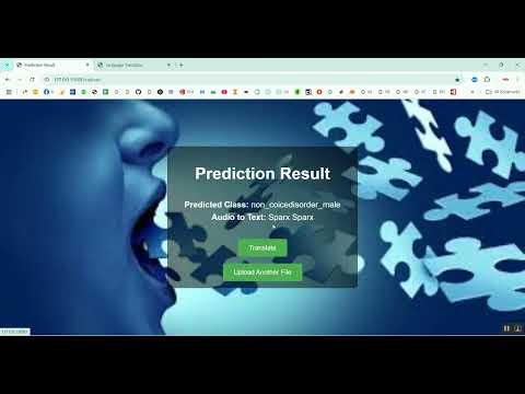
Voice Disorder Prediction using Audio Dataset in Python Projects
Voice Disorder Prediction using Audio Dataset in Python Projects
र 1000
AI & ML Models
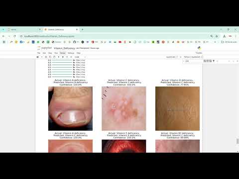
Vitamin Deficiency Detection Using Image Processing in Python Projects
Vitamin Deficiency Detection Using Image Processing in Python Projects
र 1000